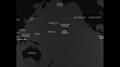
Map of major port cities in Pacific Ocean; US military in Guam in 1940s
Animated map of Pacific Ocean with islands and surrounding countries, lines appear with most showing distances from various port cities to Pearl Harbor / CU map section showing triangle connecting Tokyo, Manila and Pearl Harbor, aircraft carrier appears with planes going to Guam / Governor's palace in Guam, US flag flying in front / vehicle driving onto US Naval base / US Marine soldiers carrying their rifles running from barracks / Marines marching / Note: exact year not known; documentation incomplete


COMPRAR UMA LICENÇA
Informe quando, onde e como deseja usar este arquivo para receber ofertas de preço personalizadas.
DETALHES
ID Editorial:
637716978
Coleção:
Sherman Grinberg Library
Data da criação:
01 de janeiro de 1945
Data do upload:
Tipo de licença:
Direitos prontos
Info sobre autorização:
Sem autorização Mais informações
Duração do clipe:
00:00:45:07
Local:
Guam
Masterizado em:
QuickTime 10-bit ProRes 422 (HQ) HD 1920x1080 23.98p
Filmado originalmente em:
35mm B/W Neg
Fonte:
Sherman Grinberg Library
Nome do objeto:
sr002213_01_02.mov
- Mapa,
- Base Militar,
- Guam,
- Marinha,
- Ataque a Pearl Harbour,
- Base naval,
- Carregar,
- Greater Manila Area,
- Ilha,
- Manila - Filipinas,
- Pearl Harbor,
- Segunda Guerra Mundial,
- Soldado - Exército,
- 1940-1949,
- Animação,
- Avião,
- Bandeira,
- Bandeira Norte-Americana,
- Cidade,
- Conexão,
- Conflito,
- Corpo de Fuzileiros Navais dos EUA,
- Dirigir,
- Distante,
- Documento,
- Documentário,
- Documentário cinematográfico,
- Era Showa,
- Exatidão,
- Exército Americano,
- Filme - Imagem em Movimento,
- Filme de arquivo,
- Formato de Alta Definição,
- Fuzileiro Naval,
- Governador,
- Guerra do Pacífico,
- Ilhas do Pacífico,
- Incompleto,
- Locais geográficos,
- Mar,
- Marchar,
- Marinha Americana,
- Meio de Transporte,
- Mostrar,
- Oceano Pacífico,
- Palácio,
- Porta-aviões,
- Preto e branco,
- Quartel,
- Rifle,
- Rodear,
- Segmento editado,
- Tempo Real,
- Triângulo - Formato Bidimensional,
- Tóquio,
- Variação,
- Vida Urbana,
- Voar,
- Áudio disponível online,